Georeferencing and 3D Mapping
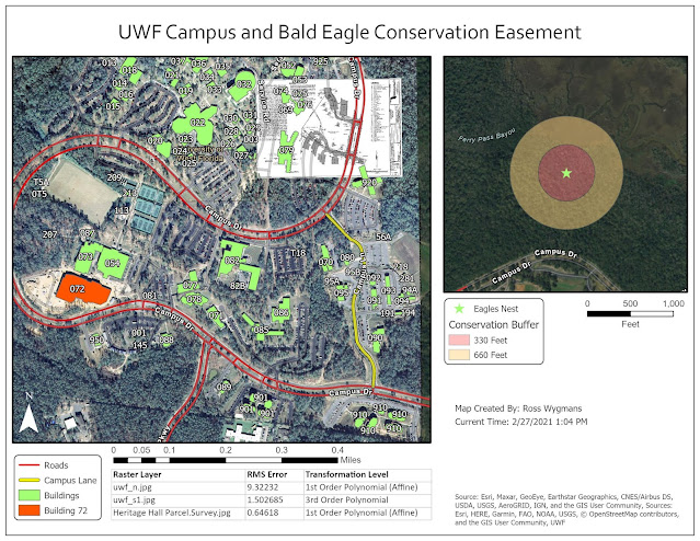
This weeks lab introduced us to the concept of georeferencing, which essentially means taking a raster dataset (such as an aerial image) with no coordinate information and aligning it in the correct place. Georeferencing is particularly helpful when working with datasets created prior to the widespread use of GIS, such as scans of old surveys or paper maps. We also learned how to create new polygon and line features within a vector layer.
In the second portion of the lab, we used LIDAR data to create a 3D map of the University of West Florida main campus. The LIDAR data was first converted to an elevation raster layer and then the aerial images were draped over the top top of the elevation layer.
In the second portion of the lab, we used LIDAR data to create a 3D map of the University of West Florida main campus. The LIDAR data was first converted to an elevation raster layer and then the aerial images were draped over the top top of the elevation layer.


Comments
Post a Comment